$60,000
Webster, WI 54830
MLS# 6526699
Status: Pending

1 / 2


Property Description
20 acres located in Burnett and another 20 acres adjacent to the North on the Douglas County Line. 40 Acres total acres. Seller will not divide the two 20 acres. The 2nd PID # for the North 20 acres is DA0100008064-01, Doulas County. The beautiful Chases Brook runs North and South through both properties. There is some open areas and some field area as well as wooded. This property is great for a variety of uses. Refer to maps for location of these parcels.
Details
Documents
Contract Information
Digitally Altered Photos: No
Status: Pending
Off Market Date: 2024-04-27
Contingency: None
Current Price: $60,000
Original List Price: 60000
ListPrice: 60000
List Date: 2024-04-26
Owner is an Agent?: No
Auction?: No
Office/Member Info
Association: SPAAR
General Property Information
Comp Sale YN: No
Development: No
Lot Measurement: Acres
Multiple PIDs?: No
Plat Recorded: No
Road Btwn WF & Home?: No
Waterfront Present: Yes
Yearly/Seasonal: Yearly
Zoning: Forestry
Lot Dimensions: 2640X660
Acres: 39.5
Location, Tax and Other Information
AssocFeeYN: No
Legal Description: E 1/2 NE NW (W /EASE # 388115)
Listing City: Webster
Map Page: 999
Municipality: Blaine Twp
School District Phone: 715-866-4391
House Number: XXX
DNR Lake ID#: 2457000
Street Name: State Hwy 35
DNR Lake Classification: Not Applicable
Postal City: Webster
County: Burnett
State: WI
Zip Code: 54830
Zip Plus 4: 9007
Property ID Number: 070042421503201000011001
Tax Year: 2023
In Foreclosure?: No
Tax Amount: 320
Potential Short Sale?: No
Lender Owned?: No
Directions & Remarks
Public Remarks: 20 acres located in Burnett and another 20 acres adjacent to the North on the Douglas County Line. 40 Acres total acres. Seller will not divide the two 20 acres. The 2nd PID # for the North 20 acres is DA0100008064-01, Doulas County. The beautiful Chases Brook runs North and South through both properties. There is some open areas and some field area as well as wooded. This property is great for a variety of uses. Refer to maps for location of these parcels.
Directions: Go North from Danbury, Wi. on Hwy 35 to the "DOUGLAS COUNTY LINE" sign. For Sale sign on Driveway, Go East to property line.
Assessments
Tax With Assessments: 130
Builder Information
Builder Restrictions: Open
Elevation Highpoint to Waterfront Feet
Elevation Highpoint Waterfront Feet: 0-4
Lake Details
Lake Acres: 5
Lake Depth: 30
Lease Details
Land Leased: Not Applicable
Miscellaneous Information
Homestead: No
Ownership
Fractional Ownership: No
Public Survey Info
Range#: 15W
Section#: 03
Township#: 42
Property Features
Available Utilities: None Available; None Connected
Development Status: Raw Land
Elevation Highpoint to Waterfront Slope: Level
Improvements: None
Lake/Waterfront: Creek/Stream; Other
Land Inclusions: None
Restriction/Covenants: None
Road Responsibility: Private Maintained Road
Sale Options: Sell Entirely
Surface Water: Stream/Creek
Topography: Low Land; Rolling
Waterfront View: See Remarks
 Map 40A .pdf
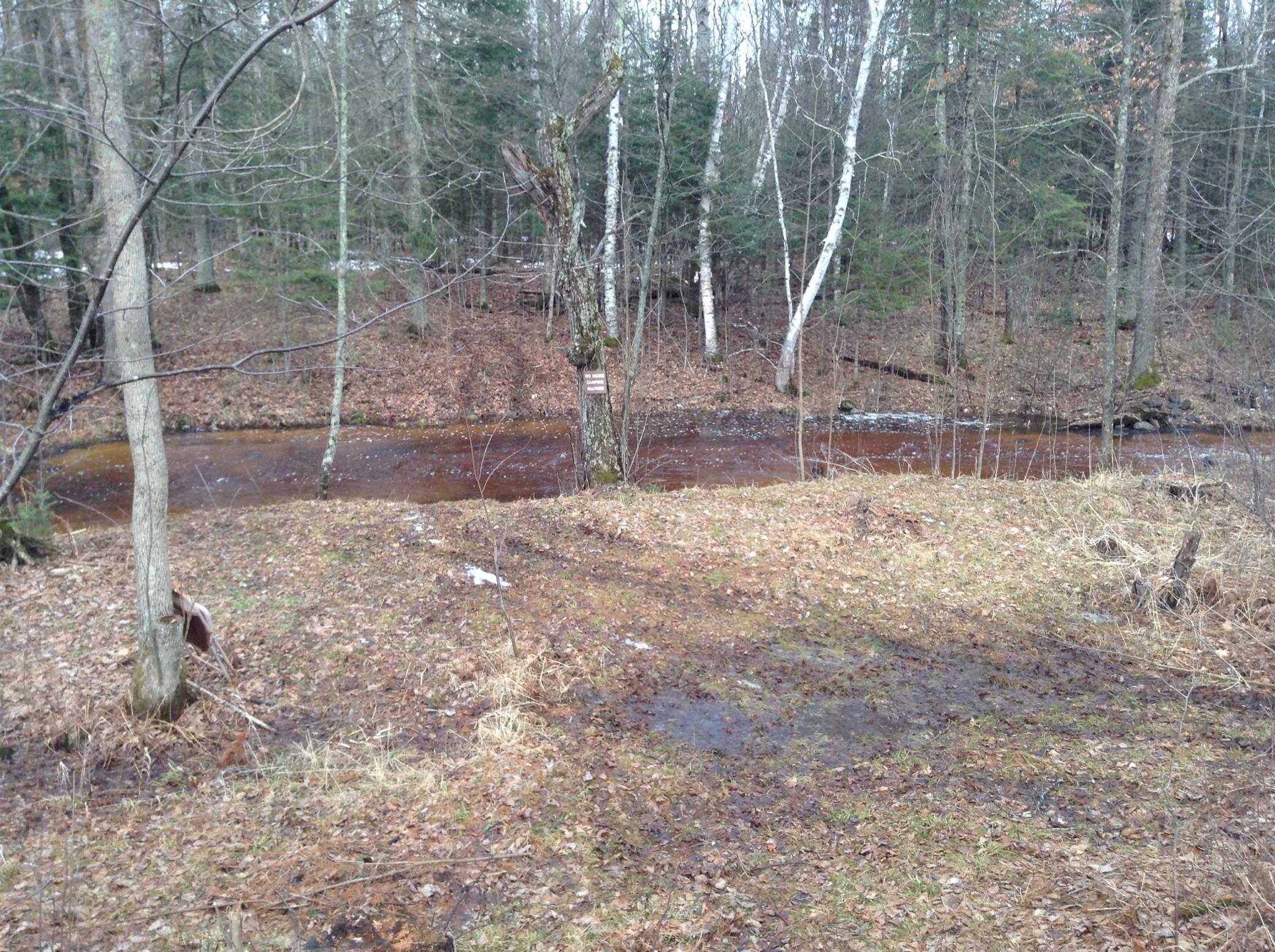
Listing Office: Timber Ghost Realty, LLC
Last Updated: April - 29 - 2024

The listing broker's offer of compensation is made only to participants of the MLS where the listing is filed.
The data relating to real estate for sale on this web site comes in part from the Broker Reciprocity SM Program of the Regional Multiple Listing Service of Minnesota, Inc. The information provided is deemed reliable but not guaranteed. Properties subject to prior sale, change or withdrawal. ©2024 Regional Multiple Listing Service of Minnesota, Inc All rights reserved.